Map showing the levelling from the Mediterranean to the Dead Sea.
London: published for the Journal of the Royal Geographical Society, by J. Murray, Albemarle Street, 1866.
Extremely rare offprint, ‘a milestone in the geographical study of Palestine... [that] showed for the first time that the Dead Sea was 395 metres below the level of the Mediterranean’ (Gavish, pp.10-11).
This map was separately printed for fellows of the Royal Geographical Society, and is bibliographically distinct from that map which appeared in the Journal of the Royal Geographical Society of London, Vol. 36, (1866), to accompany Col. Sir Henry James’, ‘An account of the levelling from the Mediterranean to the Dead Sea by Captain C.W. Wilson, R.E., and a party of Royal Engineers from the Ordnance Survey’ pp. 201-203.
The stated aim of the survey was ‘for the accurate and systematic investigation of the archaeology, the topography, the geology and physical geography, &c, of the Holy Land for Biblical illustration.’ In James’ article, he notes that the survey carved 55 Ordnance Survey benchmarks into rocks and other monuments along the line, thus laying a baseline for future mapping surveys, while also establishing for the first time the correct levels for Jerusalem against the Mediterranean. The distinctive Ordnance Survey arrowhead benchmarks – used to fix spot heights above sea level – still exist today; there is one engraved on the Jaffa Gate entrance to the Old City of Jerusalem. Those benchmarks indicating heights below the level of the Mediterranean were reversed.
This survey and mapping was undertaken by Charles Wilson between his publication of the first accurate map of the city of Jerusalem (1865) and his leading role in the Palestine Exploration Fund’s Survey of Palestine (1872-1877).
Dov Gavish. A Survey of Palestine under the British Mandate, 1920-1948 (Abingdon, 2005).

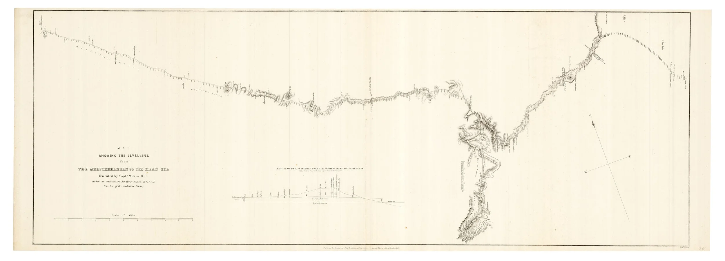 Image 1 of 1