Unidentified Second World War Russian map of Germany and Central Europe

£45.00

Anonymous. Карта Германии [Map of Germany in Russian].

N.p., n.d., [but c.1944].

An unidentified Russian map from the Second World War with Soviet troop movements indicated in red chinagraph pencil. Despite researches in various library databases, we cannot trace a Russian map that matches this scale and size. It is also interestingly annotated, with Soviet advances through Poland westward from Rzeszów indicated marked as moving slightly north to take Wrocław, before swinging south to Pardubice in modern-day Czech Republic. A ring of red circles to the south-east of Berlin indicates the Red Army’s intentions, although there are other red circles further west in Germany, including Nuremburg and Stuttgart. Most other western cities are circled in black ink, although Bremen is also ringed in red with what looks like an arrow of advance pointing towards Hamburg. Cities to the north east along the Baltic coast and extending further south along the pre-war Polish-German border are also ringed in black ink.

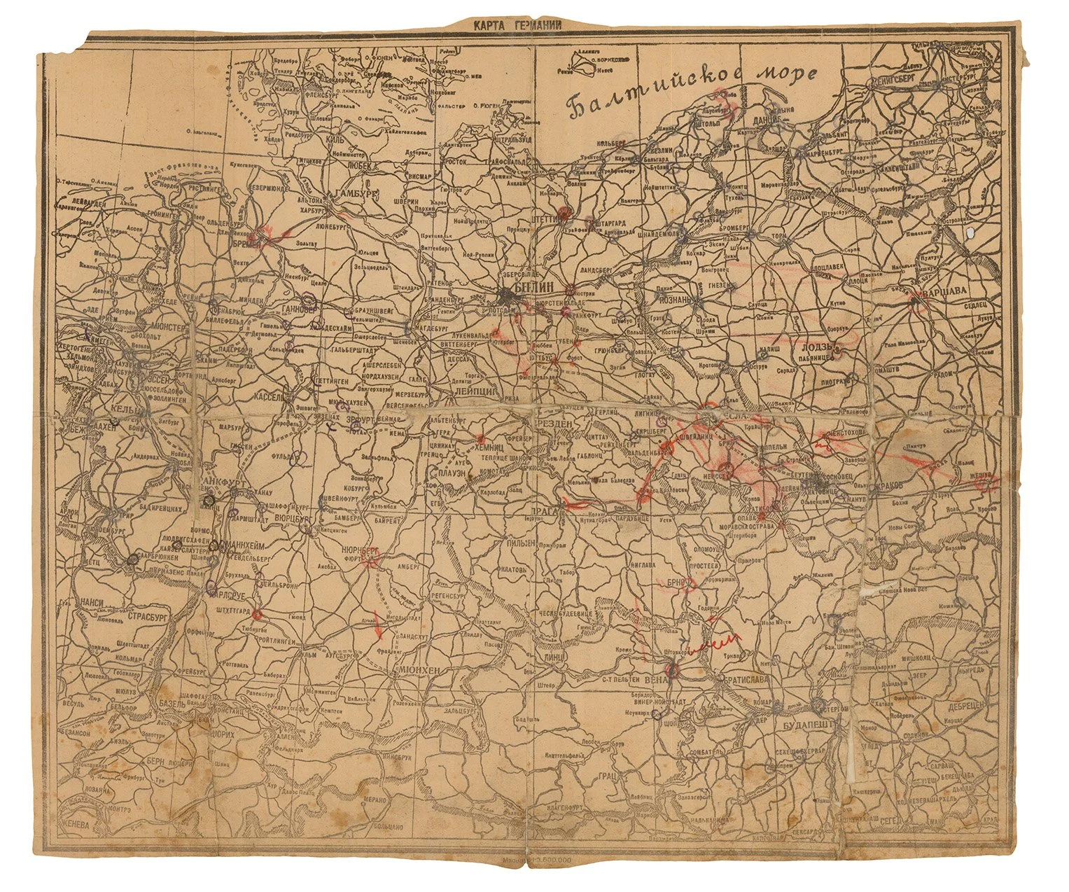
Lithographic map (293 x 342mm), extending from Sylt in the north to Klagenfurth in the south, and from Aachen in the west to Rzeszów in the east, pre-Second World War international boundaries marked with black shading, scale of 1:1,600,000. (Sometime folded and repaired with extensive old paper repairs on verso, faint creasing, soiling and occasional abrasion and fading with associated loss of a few letters, small chip to north-west corner with loss of border but mainly affected blank North Sea area.)

Provenance: Ilya Parafina (ownership inscription in pencil on verso) – markings in red chinagraph pencil and black ink.