
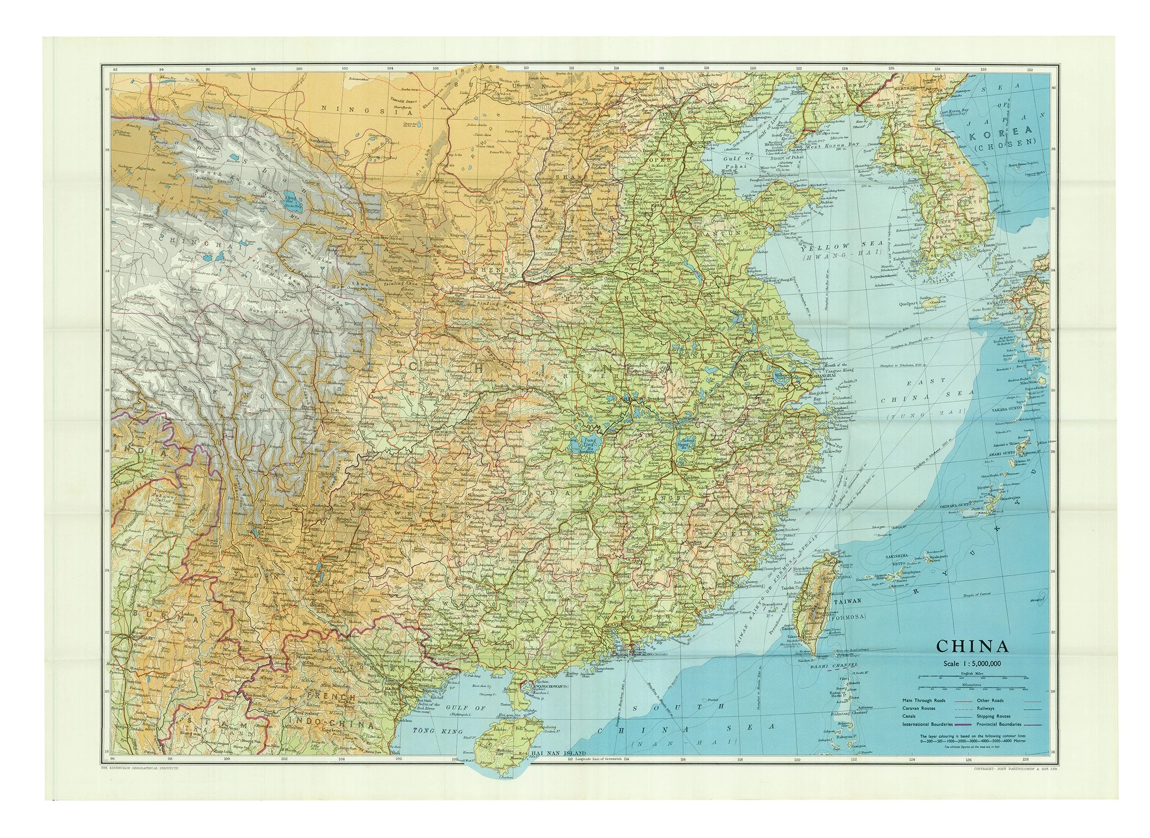
 Image 1 of 4
 Image 2 of 4
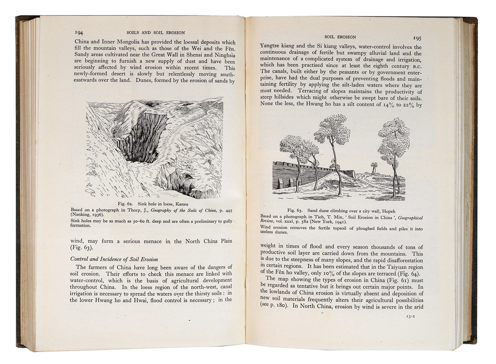 Image 3 of 4
 Image 4 of 4
3 volumes, octavo (215 x 138mm). Vol. I Physical Geography, History and Peoples: xvi, 542 pp., 122 maps and diagrams, 143 plates, large folding map in pocket at end; vol. II Modern History and Administration: xii, 370 pp, 35 maps and diagrams 64 plates; vol. II Economic Geography, Ports and Communications: xiv, 653 pp. 94 maps and diagrams, including a folding map of Shanghai Harbour, 160 plates. (Faint occasional scattered spotting mainly confined to title-pages and final leaf of vol. III, slight cracking of textblock in vol. I between pp.xvi-1, last few leaves of vol. I faintly dogeared.) Original green cloth gilt (spines faded, extremities lightly rubbed, slightly more heavily to upper joint of vol. I with tiny loss, a few corners slightly bumped).
Provenance: Andover Boys Secondary School (ink stamps and neat ink classmarks to front pastedowns).