
 Image 1 of 5
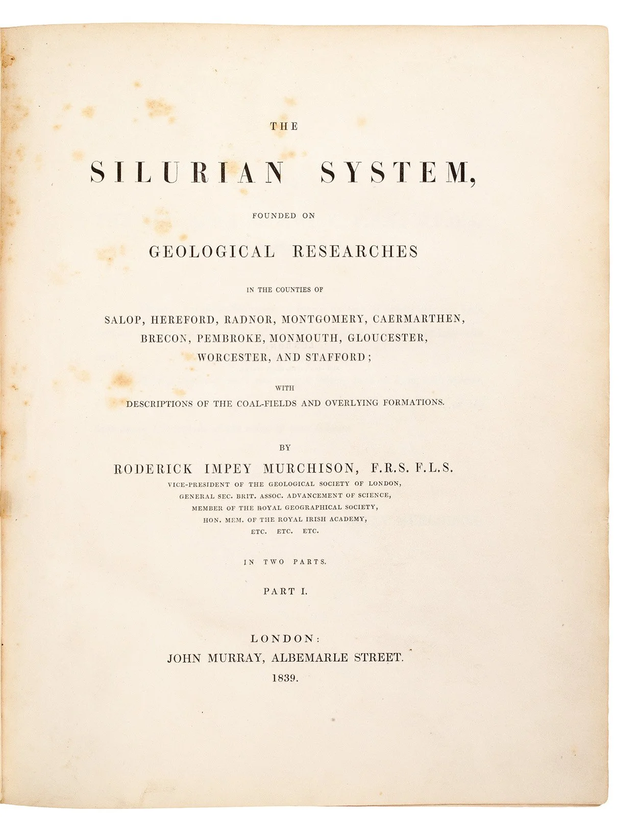 Image 2 of 5
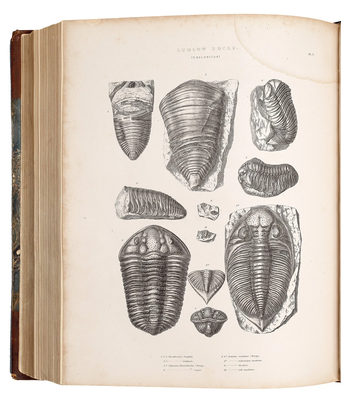 Image 3 of 5
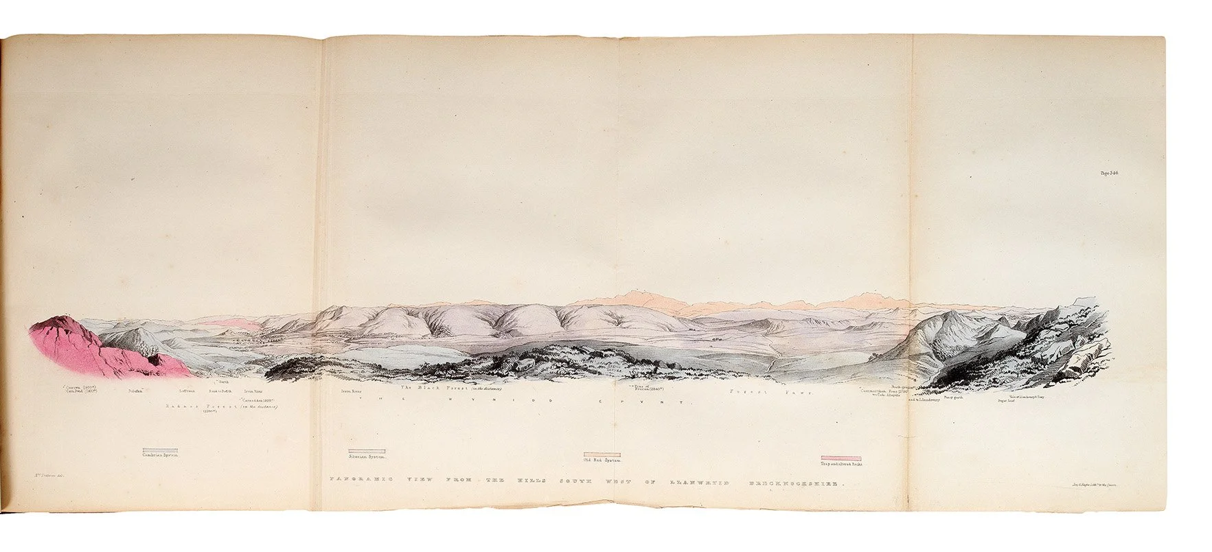 Image 4 of 5
 Image 5 of 5
Murchison was born in Tarradale, Easter Ross, into a prosperous family. He was educated at Durham School and the military college at Great Marlow, later serving in the British Army during the Peninsular War. After leaving the army in 1815 and marrying Charlotte Hugonin, Murchison initially pursued art and antiquities on the Grand Tour, and then settled at Castle Barnard, Co. Durham, where he seems mainly to have enjoyed field sports. However, inspired by meeting Sir Humphry Davy in 1823, Murchison turned to science, and moved to London.
Geology attracted him immensely, and by January 1825 he was a fellow of the Geological Society. The following year, his star had risen sufficiently for him to hold the position of Secretary, and five years later, in 1831, he was elected President. Murchison had a talent for organisation and an understanding of the work required to sustain a learned society; he was a member of Raleigh Travellers' Club, and was present at a meeting on 24 May 1830 at Raleigh's to found the Royal Geographical Society. He was also a founder member of the British Association for the Advancement of Science, attending its inaugural meeting at York on 27 September 1831, where he described the preliminary results of his fieldwork undertaken that summer in south Wales.
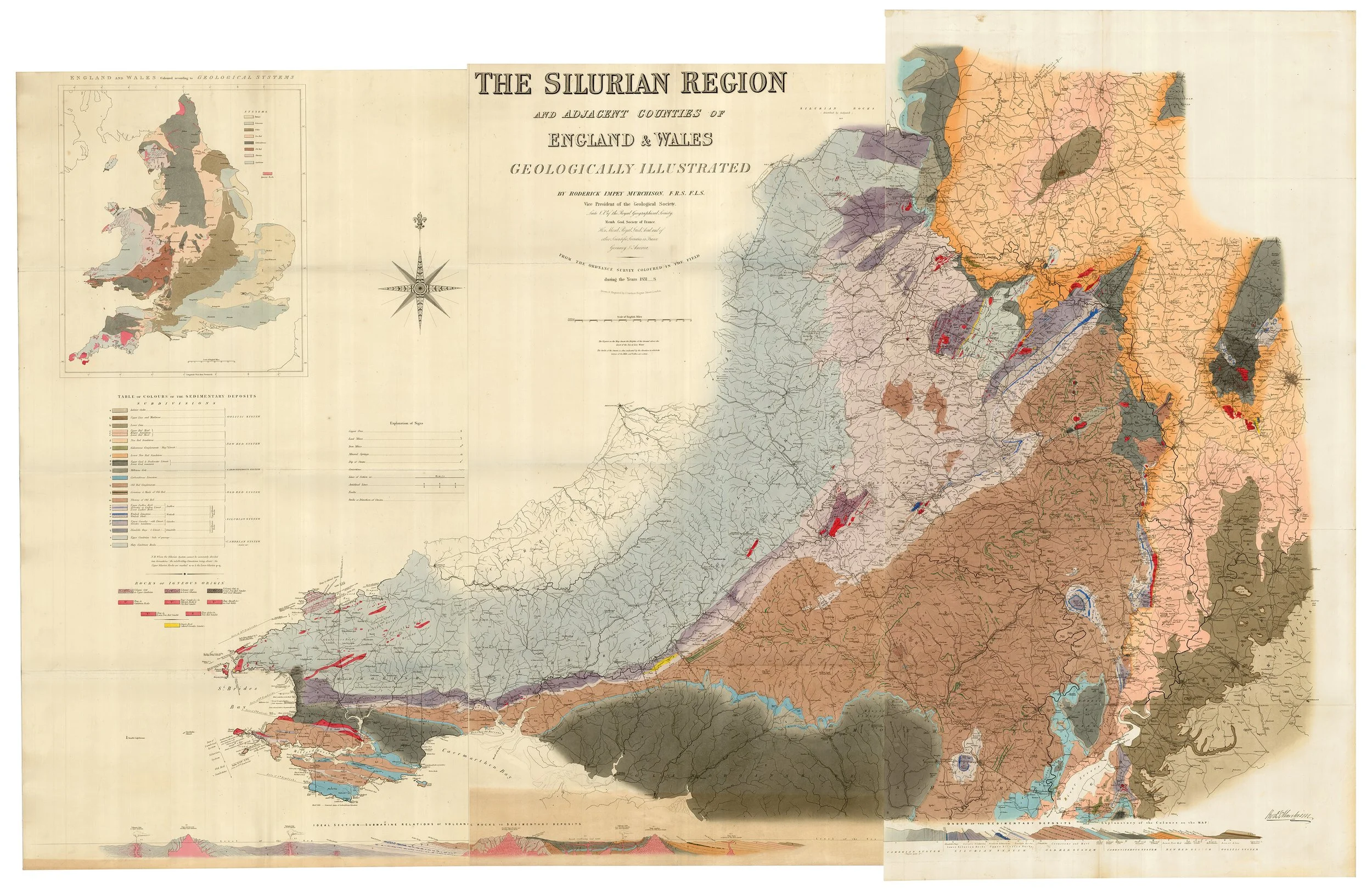
This fieldwork – an attempt to discover whether the greywacke rocks underlying the Old Red Sandstone could be grouped into a definite order of succession – resulted in the establishment of the Silurian system under which were grouped, for the first time, a remarkable series of formations, each replete with distinctive organic remains other than and very different from those of the other rocks of England. 'Murchison was the first to establish a uniform sequence of Transition strata, to which he gave the name "Silurian" after a British tribe; these strata constituted a major system with uniform fossil remains, displaying an abundance of invertebrates and a complete lack... of the remains of vertebrates or land plants' (Norman).
Thus, the implications of Murchison researches for the evolutionary history of the Earth were enormous. However, with his old friend Adam Sedgwick working in the northern part of Wales, and Murchison to the south, they failed to realise that the lower part of Murchison's system of strata was equivalent to the upper part of that called Cambrian by Sedgwick. Murchison's pride in his work led to such territorial possessiveness, that he destroyed his friendship with Sedgwick over the Cambrian-Silurian boundary, and although he won the day through advocacy, the dispute was settled only after several decades of controversy with the adoption of Charles Lapworth's 1879 proposal that an ‘Ordovician system’ define the debatable ground.
Today, the Silurian is understood as a geologic period and system that extends from the end of the Ordovician Period, about 443 million years ago, to the beginning of the Devonian Period, about 416 million years ago. As with other geologic periods, the rock beds that define the period's start and end are well identified, but the exact dates are uncertain by several million years. The base of the Silurian is set at a major extinction event when 60% of marine species were wiped out.
A full history and bibliographic description of the work is given by Thackray, although he omits mention of the 3 engraved topographical maps printed on 2 sheets. Suffice to mention here that Murchison received substantial help from Arthur Aikin with notes on Shropshire, while J. de C. Sowerby described the shells, Louis Agassiz (1807-1873) the fishes, William Lonsdale (1794-1871; curator of the Geological Society's museum) the corals, while Charles Stokes (1783-1853) aided Murchison on describing the trilobites. Delays in publication were caused in the main by Sowerby's slow delivery of the plates, combined with Murchison's changes of mind, leading to errors which needed to be corrected. Printing was completed by the end of December 1838, with the book published on, or shortly after 1st January 1839. In the final publication, the only corrigenda is a slip issued on 5th January 1839 which is pasted opposite the first plate drawing attention to the incorrect arrangement of shells on plates 21 and 22. 398 subscribers accounted for 452 copies; the entire print-run was probably around 800 copies. Despite the rarity of the large map today – most copies in commerce are lacking it – every copy of the book was published with the map. Silurian System remained available from John Murray for two years at 8 guineas, and by 1841 H.G. Bohn was offering a few remaindered copies at 6 guineas.
Challinor 141; Donovan p.117; Norman 1569; F. J. North. Geological Maps: their history and development, with special reference to Wales (Cardiff, 1928), 10 (map);.J.C. Thackray, ‘R.I. Murchison’s Silurian System (1839)’, Journal of the Society for the Bibliography of Natural History 9 (1978), pp.61-73; Ward & Carozzi 1620; cf. Martin J.S. Rudwick. The meaning of fossils: episodes in the history of palaeontology (London, 1972), pp.191-203.
2 parts in one volume, quarto (320 x 270mm); pp.xxxii, 768, 3 engraved topographical maps on 2 sheets, 14 lithographic plates of which 2 folding and 3 hand-coloured, 9 folding hand-coloured engraved geological sections, 31 plates of fossils of which 25 are engraved and 6 are lithographs, 112 wood-engraved text illustrations. (Occasional spotting affecting some plates more heavily.) Contemporary half morocco over marbled-paper covered boards (rebacked, preserving original spine, extremities rubbed, recently refurbished with expert repair to rear inner hinge).